Driving the Scenic Highway 12 in Utah
After visiting Capitol Reef’s Strike Valley, Dan and I found ourselves racing along Utah’s Highway 12 in order to catch a return flight to Seattle. Our path to the Salt Lake City Airport followed the Burr Trail to Boulder, then veered right—ascending a hair-raising road up Boulder Mountain, toward Torrey.
Though spectacular views turned our heads every which way, the scenery sped by in a blur. I tried to snap photos of the moving landscape, but failed to capture its majesty through the car’s dusty windows.
Then and there, we vowed to return to the area and explore at leisure.
So one month later, while road tripping through the American Southwest, we made sure to include Highway 12 into our travel plans.
ATTRACTIONS AND DETOURS ALONG UTAH’S HIGHWAY 12
Utah’s scenic Route 12 is 122 miles of pure road trip bliss. Also known as the ‘Million Dollar Road to Boulder,’ the scenic byway has been enchanting travelers since the early 1900s.
As the road cuts through southern Utah’s parched red rock, it passes by unforgettable landscapes. The highway connects Bryce National Park with Capitol Reef National Park. In between, it traverses the Grand Staircase-Escalante National Monument and produces offshoots into remote corners of southern Utah.
In total, Route 12 winds past two national parks, three state parks, a national monument, a national recreation area, and a national forest.
It is no wonder that the scenic byway has been designated an All-American Road.
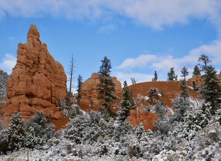
RED CANYON IN THE DIXIE NATIONAL FOREST
Utah’s Red Canyon marks the westernmost end of Highway 12. It is located in the Dixie National Forest, 10 miles west of Bryce Canyon National Park.
Like a mini version of Bryce, Red Canyon’s ochre-colored hoodoos rise from the ground like rusty stalagmites.
Many of the canyon’s most striking formations lie within eyeshot of Highway 12. In fact, in order to construct a road through the area, engineers had to blast arches through red rock spires.
Though we caught glimpses of the rock formations from our vehicle, Dan and I didn’t have time to explore the inner reaches of Red Canyon during our road trip.
BRYCE CANYON NATIONAL PARK
Bryce is a fairyland of elegant beauty and fiery colors. Renowned for its oft-photographed rock formations that pierce the sky, the canyon’s ethereal landscapes are as enchanting as they are iconic.
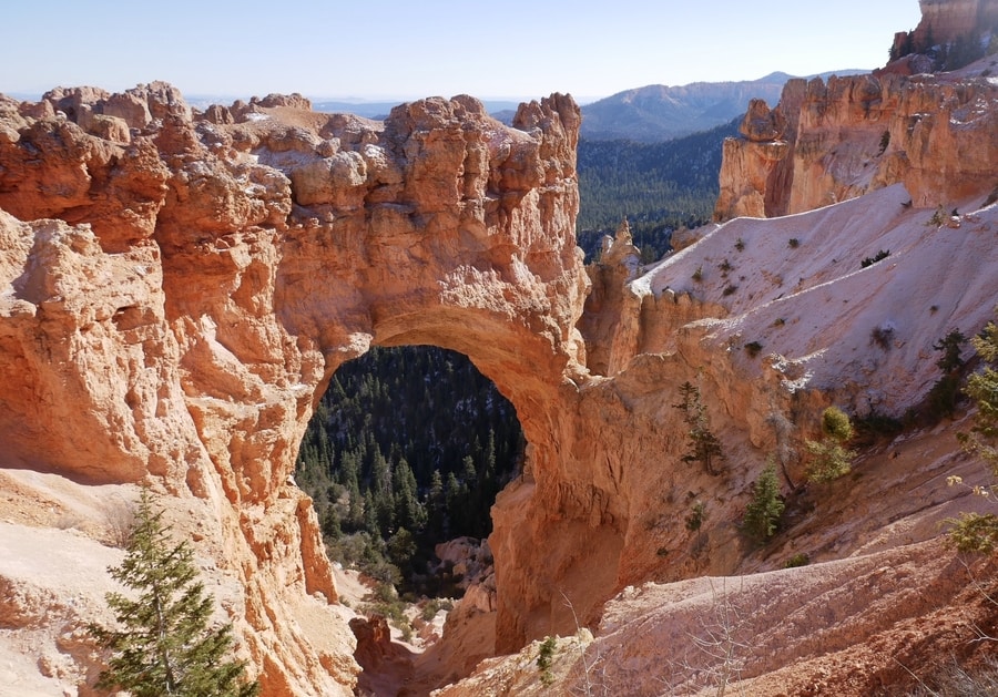
The long and narrow park hugs the eastern edge of Utah’s Paunsaugunt Plateau. Over millennia, ephemeral streams and snowmelt have sliced the plateau’s sandstone and carved horseshoe-shaped bowls. The largest and most striking bowl in the area is the Amphitheater—a stadium-like hillside that lies at the scenic heart of Bryce Canyon National Park.
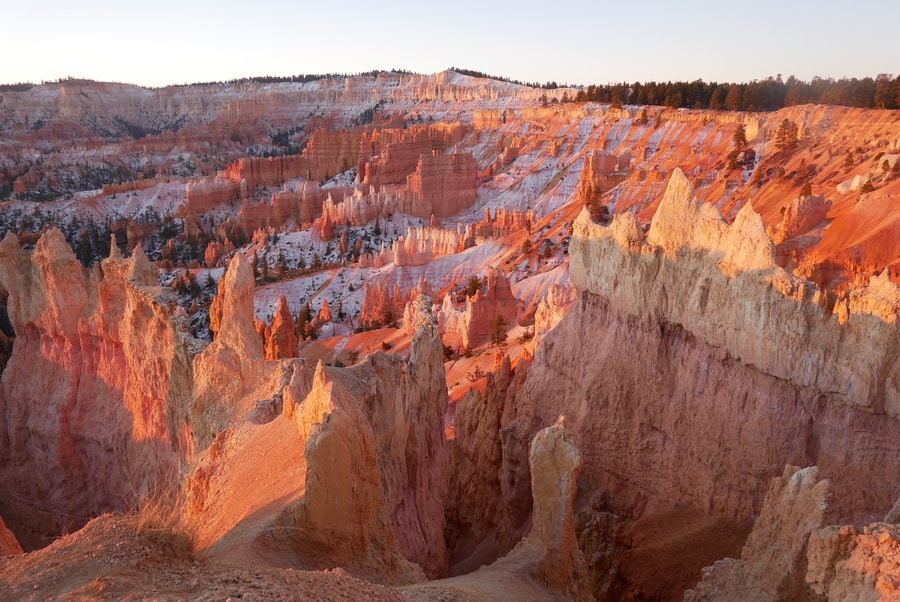
Bryce’s must-see attractions line the eastern edge of the park’s 20 mile scenic drive. Near the park entrance, iconic vistas showcase sweeping aerial snapshots of the Bryce Amphitheater. Toward the end of the road, lesser-known panoramic points offer intimate glimpses into the canyon’s more remote reaches.
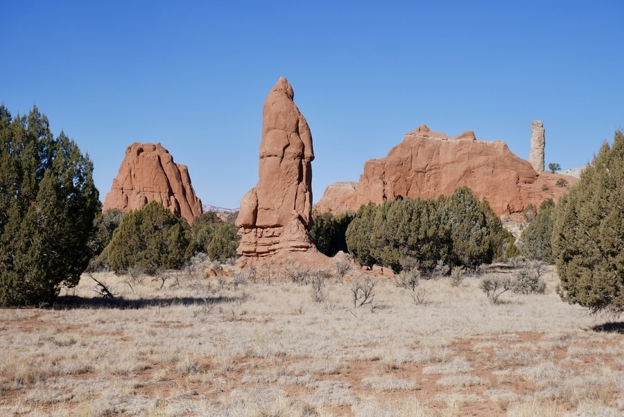
KODACHROME BASIN STATE PARK
Kodachrome Basin State Park lies 26 miles southeast of Bryce. The park is most renowned for its dozens of delicate sandstone chimneys that point to the sky like crooked fingers.
When the National Geographic Society traveled to the area in 1948, its members found themselves struck by the colorful sandstone spires. They named the area Kodachrome Flat, after the brand of Kodak film known for its vibrant color rendition.
Following our sunrise visit to Bryce, Dan and I spent a morning in Kodachrome Basin. With limited time in the area, we chose to hike the scenic Angel’s Palace Trail.
Angel’s Palace is among the most beautiful short hikes in Kodachrome State Park. It provides 360 degree aerial views over the basin’s unique landforms.
Other popular trails include the 1.5 mile Grand Parade and the 3 mile Panorama Trail.
Past the camping area, a gravel spur road deviates toward Chimney Rock—a 170 ft pipe that soars above the surrounding desertscape.
GROSVENOR ARCH IN GRAND STAIRCASE-ESCALANTE
Utah is famous for its rock arches. In fact, there is an entire national park dedicated to the state’s delicate stone bridges.
But despite southern Utah’s plethora of similar attractions, Grosvenor Arch is unique.
The colossal landmark towers over sage-speckled desert like a golden fortress surveying its surroundings. Its twin arches soar 150 ft. The larger of the two measures nearly 100 ft in diameter.
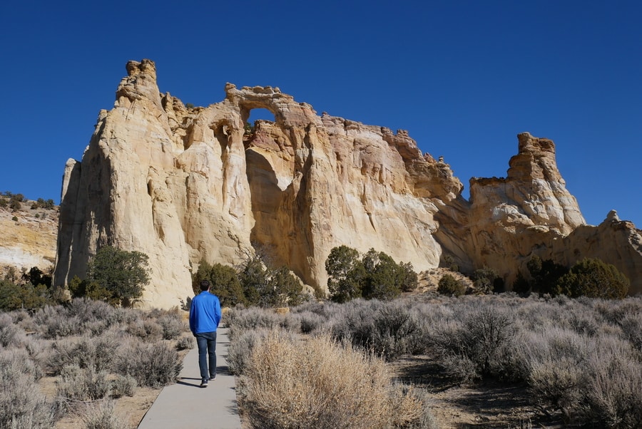
Grosvenor Arch lies down a dirt track, about 11 miles south of Kodachrome Basin State Park.
For those traveling along Utah’s Route 12, it constitutes a must-see detour.
CALF CREEK RECREATION AREA
Calf Creek is a verdant oasis that lies among tumbled stone monoliths.
Unfortunately, Dan and I had to skip Calf Creek due to lack of time.
From my understanding, however, the recreation area is one of the top places to visit along Highway 12. It boasts mineral-streaked sandstone cliffs, pre-historic carvings, photogenic waterfalls, and paradisiacal pools.
THE HOGBACK
Highway 12 in Utah features terrific hikes, spellbinding vistas, and fascinating detours.
Yet sometimes, the road itself is the main attraction.
East of Escalante, Highway 12 traces the Hogback’s spine for eleven miles. On each side of the road, 1,000 ft drops afford vertigo-inducing views over the monument’s cliffs and canyons.
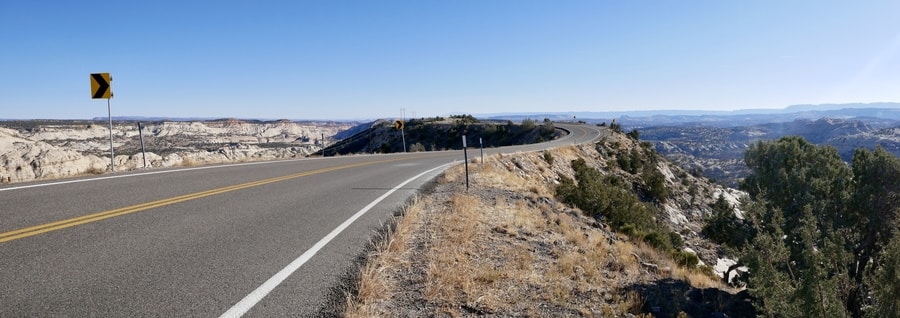
Along the way, viewpoints reveal the route’s precarious nature.
As I looked out at the ribbon of road with its sheer drops on either side, I was just glad to have a competent driver behind the wheel (thanks Dan!).
THE BURR TRAIL ROAD
Though it isn’t expressly a part of Highway 12, the Burr Trail Road makes for a fantastic detour.
The scenic route showcases a remarkable number of breathtaking attractions—including slot canyons, scenic viewpoints, and lonely offshoots that traverse juniper-laden desert.
The lightly-trafficked backway winds through dramatic portions of southern Utah. It extends for 66 miles, from the town of Boulder, to the Bullfrog Marina on Lake Powell.
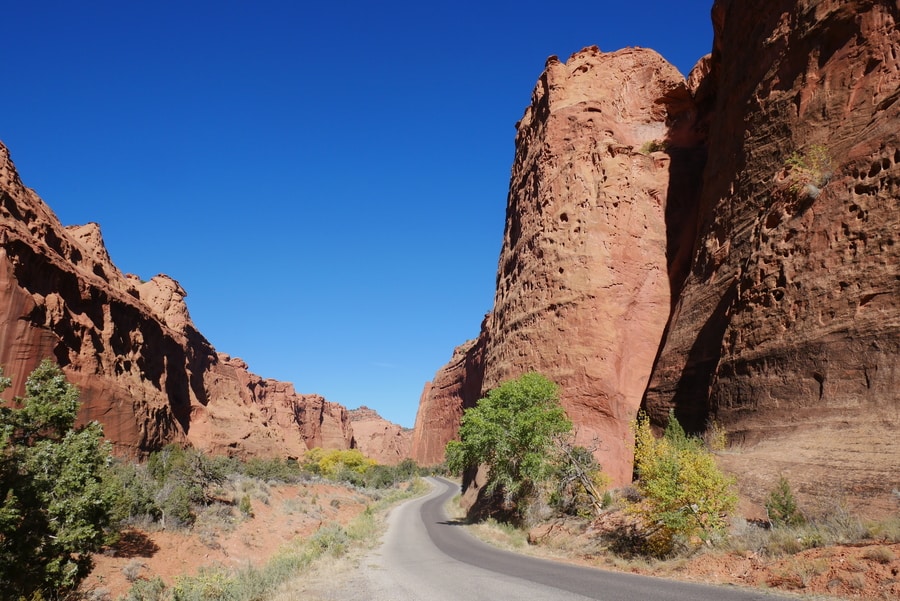
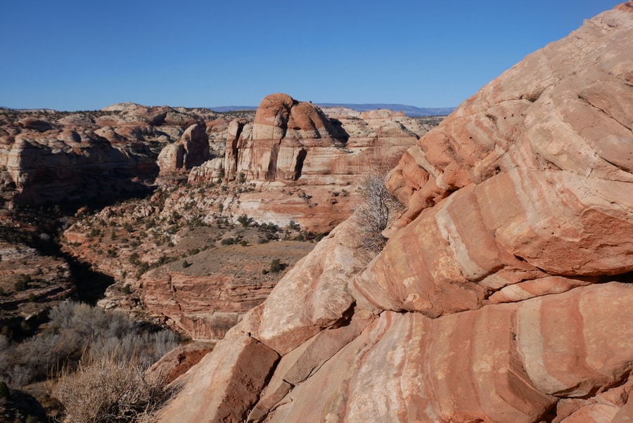
The Burr Trail Road highlights some of Grand Staircase-Escalante’s most awe-inspiring scenery. Its three distinct sections contain narrow orange canyons, rust-colored hillsides, and views of Capitol Reef’s Strike Valley.
The first portion of the Burr Trail travels through the northeastern corner of Grand Staircase-Escalante. The second, is a rough-and-tumble gravel road that cuts across the Waterpocket Fold in Capitol Reef National Park. The third, is a ribbon of pavement that connects the national park with Lake Powell’s Bullfrog Marina.
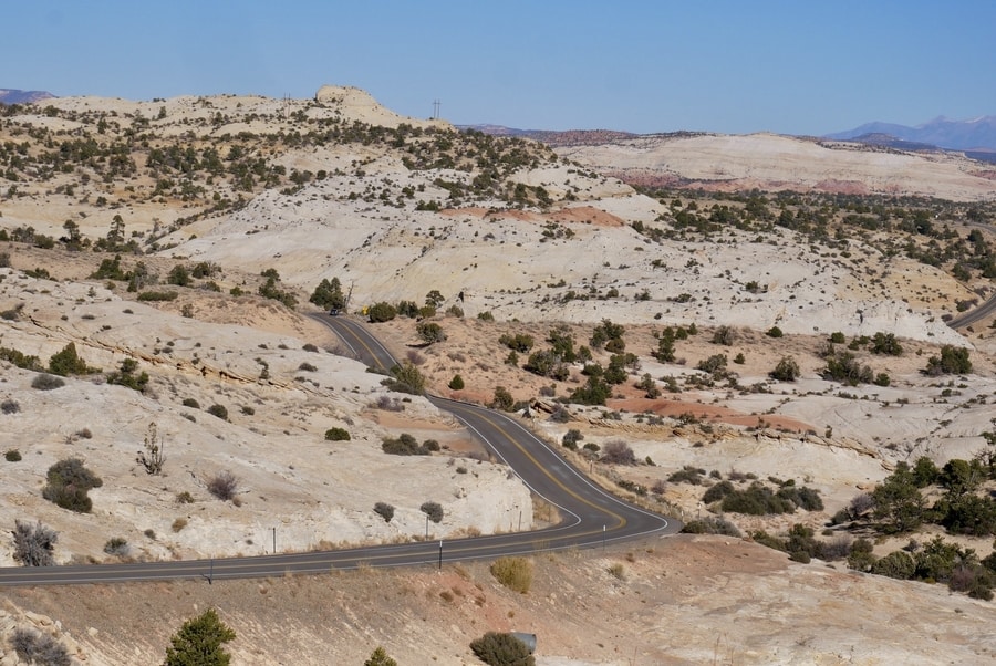
BOULDER MOUNTAIN
Boulder Mountain—the highest step in Utah’s Grand Staircase—is visible from hundreds of miles away. The colossal mountain makes up half of southern Utah’s Aquarius Plateau.
Rising over 11,000 feet in elevation, it is the highest timbered plateau in North America.
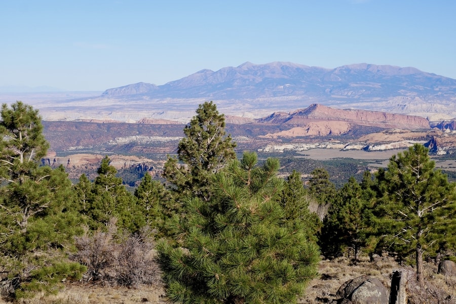
Boulder Mountain is a destination worth exploring. It boasts colorful aspen groves, rolling meadowlands, and dozens of alpine lakes.
As Highway 12 ascends the plateau on its way to Torrey, it reveals spectacular aerial views of Capitol Reef to the east.
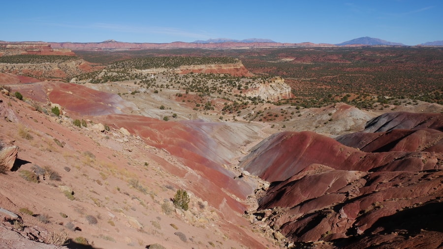
CAPITOL REEF NATIONAL PARK
Capitol Reef National Park is the least visited of Utah’s Mighty 5. The park’s main feature is the Waterpocket Fold—a buckle in the earth’s crust that extends for over 100 miles.
Capitol Reef consists of three main sections: the Fruita District, the Waterpocket District, and the Cathedral District. The Fruita District is the hub of tourism in Capitol Reef. It is by far the most trafficked area of the park.
Visiting the other two areas requires a 4 wheel drive vehicle that can negotiate bumpy dirt roads.
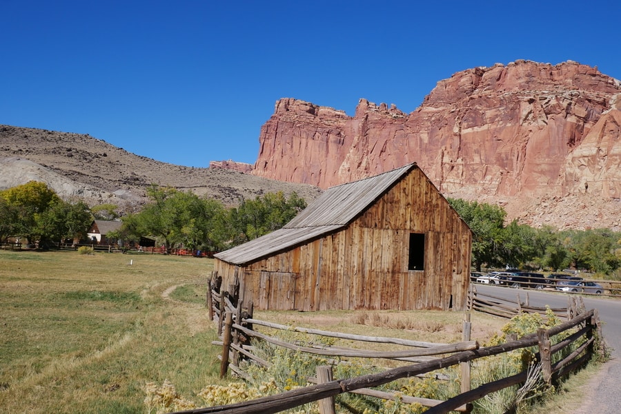
Within its confines, the national park harbors fantastic hiking trails, towering monoliths, natural arches, and 1000-year-old petroglyph panels.
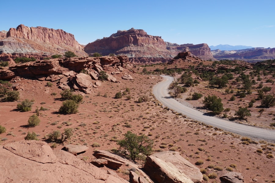
Capitol Reef National Park isn’t the type of place that can be easily visited in an afternoon. Its disjointed sections require lengthy drives on bumpy roads.
However, if given the time and patience that it deserves, Capitol Reef is every bit as impressive as Utah’s other more renowned national parks.
LODGING ALONG UTAH’S HIGHWAY 12
Highway 12 in Utah snakes through a rugged expanse of barren desert. While much of it lies within a patchwork of federally protected lands, a few tiny towns interrupt the endless landscape. Noteworthy towns include Tropic, Escalante, Boulder, and Torrey. Each has gas stations and a handful of accommodation options.
Tropic lies just east of Bryce Canyon National Park, near Kodachrome Basin. It houses the Bryce Country Cabins and Happy Trails B&B.
Escalante sits at the midway point of the drive and is a hub for exploring the Grand Staircase-Escalante National Monument. It offers some of the best lodging options along the route—including the Ponderosa Inn and the Slot Canyons Inn Bed and Breakfast.
In Boulder, Annie’s Place Bed and Breakfast boasts fantastic reviews.
And in Torrey, the Capitol Reef Resort offers unique rooms that provide views of the park’s red rock landscape.
****
Highway 12 in Utah is no ordinary road. The spectacular route is chock full of roadside attractions, sweeping vistas, and fascinating detours.
The scenic byway’s little-known attractions are often unexpectedly epic. Along each bend in the road, adventure beckons.
I have no doubt that Highway 12 is one of the Southwest’s great road trips.
For while many race to the national parks that bookend its expanse, the ‘Million Dollar Road to Boulder’ is a destination unto itself.
____________________________________________
Did You Enjoy this Guide to Highway 12 in Utah? Pin It!