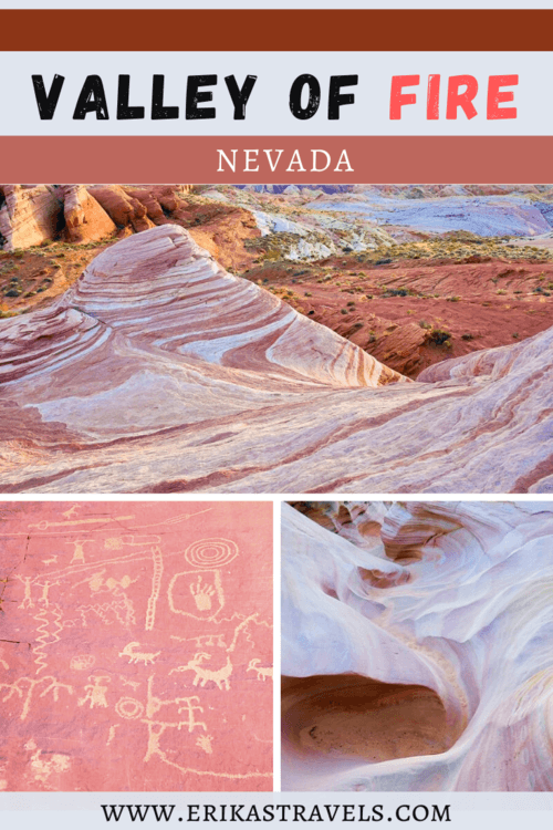
Things to Do in Nevada’s Valley of Fire State Park
Valley of Fire State Park may be only 50 miles from downtown Las Vegas, but it feels world’s away from the city’s casino-flanked strip. Throughout the park, the stillness of nature replaces a constant whirl of slot machines, and age-old rocks tell the stories of those who once called the area home.
The Valley of Fire lies amidst a seemingly endless expanse of parched grey rock. Covering nearly 46,000 acres of the Mojave Desert, the state park is a place where Nevada’s barren landscape puts on a dramatic and colorful display. Its orange and pink Aztec Sandstone erupts from the ground, engulfing the arid earth in an exhibit of mesmerizing hues. At dawn and dusk, it appears to be catch fire. Hence, the park’s name.
THINGS TO DO & SEE IN THE VALLEY OF FIRE
Scenery-wise, the Valley of Fire bears a closer semblance to the national parks and state parks in Utah than it does to its surrounding Nevada environs. Its warm-colored sandstone formations are similar to those found throughout the American Southwest—from Capitol Reef to Sedona, and from Zion to Goblin Valley.
Though the Valley of Fire is small with respect to the parks in nearby Utah and Arizona, it is teeming with things to do and see. The red rock playground boasts photogenic viewpoints, meandering hiking trails, ancient pictographs, and curious rock formations.
VALLEY OF FIRE VIEWPOINTS AND ATTRACTIONS
The Valley of Fire’s scenic drive follows two main arteries through the state park. One—Valley of Fire Road—connects the park’s western and eastern entrances. Near the visitor center, a perpendicular offshoot (Mouse’s Tank) heads north to the start of the White Domes trailhead.
The entire drive through the Valley of Fire reveals a landscape drenched in saturated color tones. If you are visiting as a day trip from Las Vegas and only have a few hours in the park, a number of roadside attractions give a sense of the area’s history and geology.
With more time, the Valley of Fire’s hiking trails reveal a land of iconic photography locations and little-known gems.
ATLATL ROCK
Dan and I began our Valley of Fire day trip with a brief visit to Atlatl Rock. The towering flank of sandstone sports a collection of petroglyphs that date back millennia.
A short metal staircase leads visitors to the petroglyph-viewing platform. The up-close vantage point reveals illustrations of people, animals, and symbols. Toward the top of rock, horizontal carvings depict an atlatl and a spear.
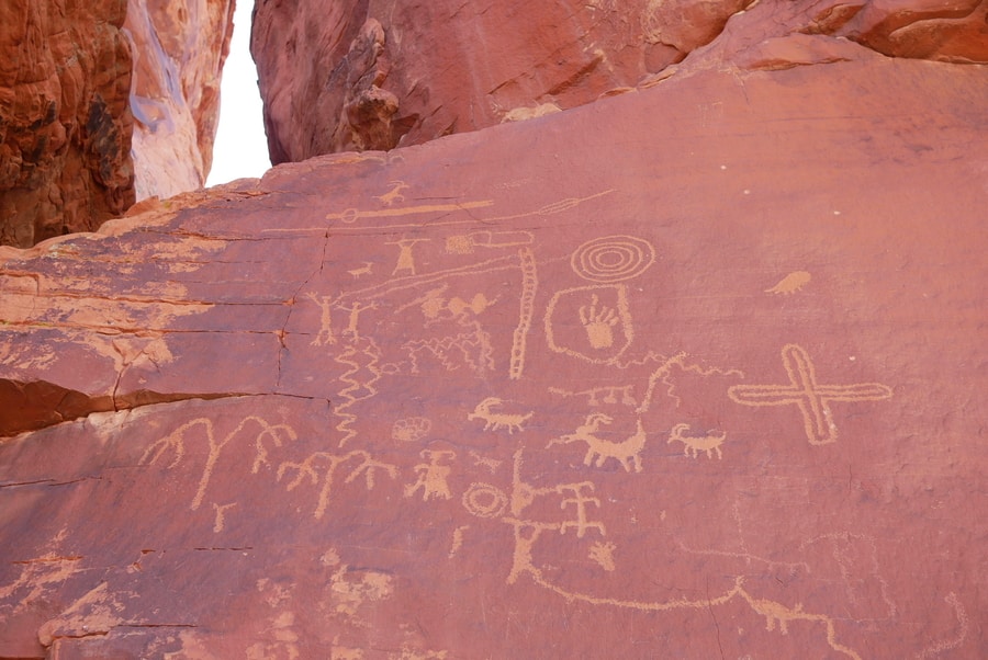
Atlatl Rock is one of the top places to visit in Nevada’s Valley of Fire. It lies along a short scenic loop, near the park’s western entrance.
ARCH ROCK
Arch Rock is among the Valley of Fire’s most notable sandstone formations. Its natural bridge formed as wind and rain slowly washed away the materials holding its sand grains together. The rock weakened over time, creating the natural arch that stands today.
Eventually, Arch Rock will collapse after growing too large for its supports. Such is the story of the American Southwest’s sandstone arches—a story that is told time and time again in this ever-shifting landscape.
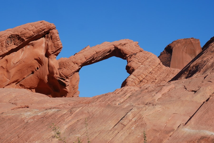
Though it doesn’t compare in scale and shape to some of the natural stone bridges in Arches National Park, Arch Rock is nonetheless a worthwhile place to visit within the Valley of Fire.
THE BEEHIVES
The Beehives sit alongside the state park’s main thoroughfare, beyond Atlatl Rock. They rise from the ground like tall stacks of pancakes and are among the Valley of Fire’s most eye-catching roadside attractions.
The Beehives are a fine example of geologic cross bedding. Much like rings on a tree, the Beehives act as a geological calendar of sorts—with their grooved lines representing layers of silt that have been deposited at different times throughout history.
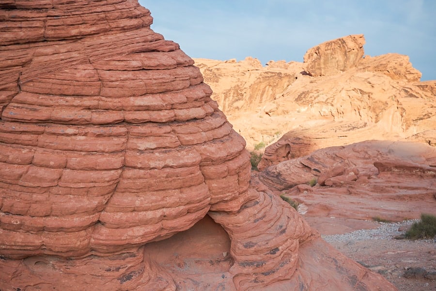
A short path winds through the area. It is a wonderful place to get out of the car and scramble around for a bit.
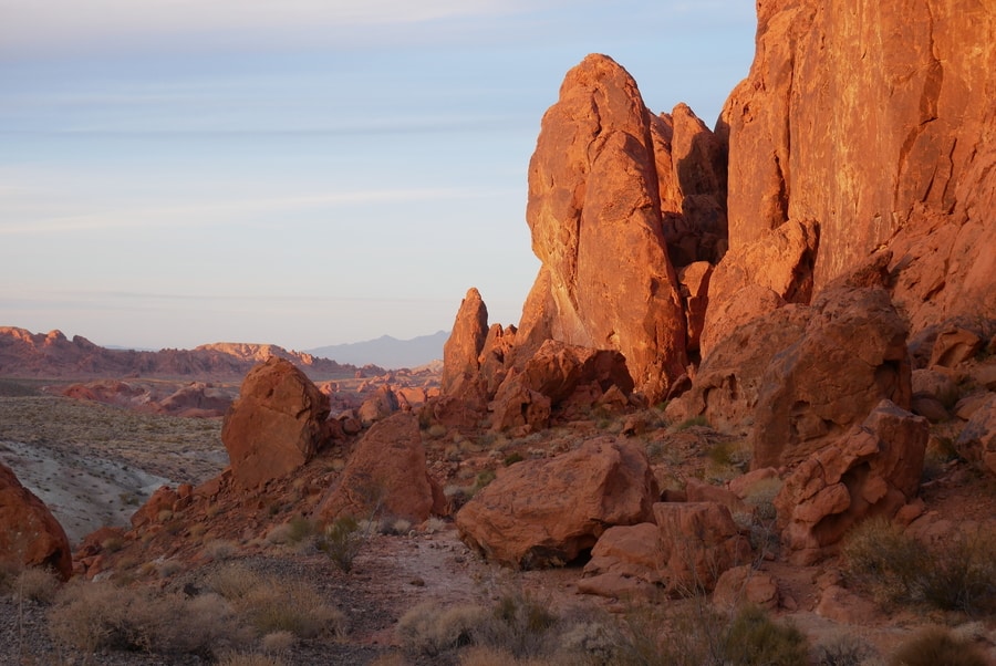
FIRE CANYON
After stopping briefly by the roadside attractions near Valley of Fire’s western end, Dan and I continued up Mouse’s Tank Road, toward the White Domes trailhead. About halfway along the road, another tentacle veered off toward Fire Canyon. We made the quick detour and stopped briefly by one of the most impressive vistas in the state park.
In the Fire Canyon, erosion has chiseled a landscape of red rock spires, weathered chasms, and jagged boulder piles.
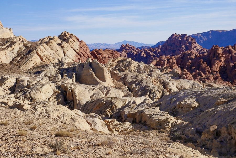
Silica Dome is the most prominent landmark in the area. The dome’s change from white to red occurs where iron in the rock produces a rust-like stain.
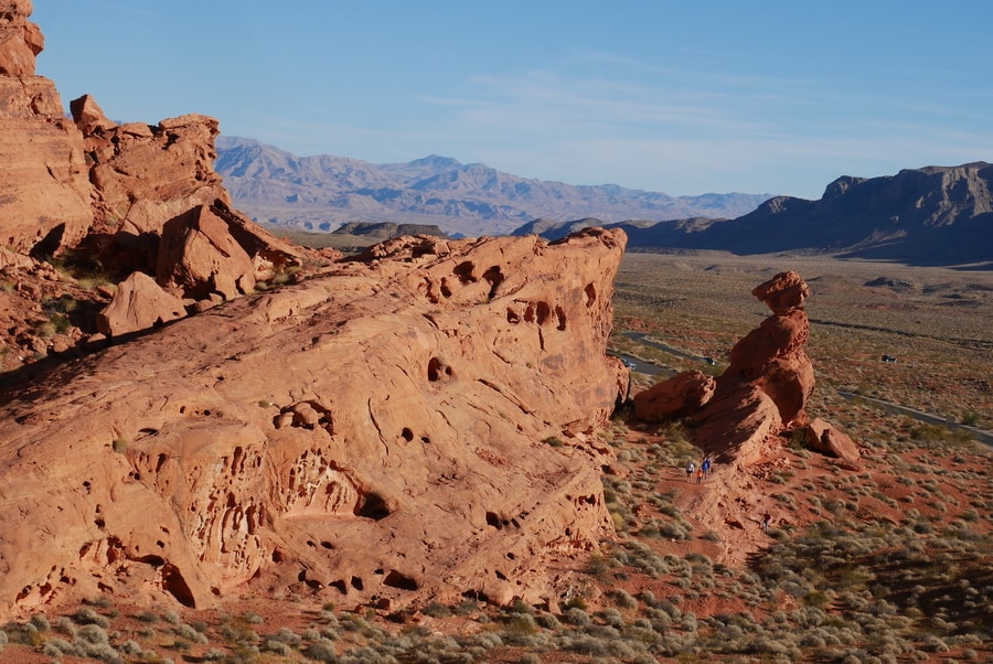
ELEPHANT ROCK
Like Arch Rock, Elephant Rock is a natural sandstone formation that makes for a quick photo opportunity. The iconic attraction lies at Valley of Fire’s eastern end, just off the main road. Due to its elephantine shape, it is one of the top things to see in the state park.
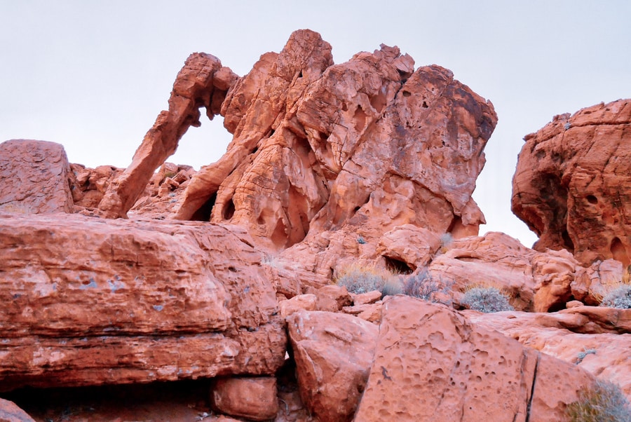
Though it is entirely possibly to view Elephant Rock from the road, a short hiking trail encircles the area and leads to panoramas of the surrounding desertscape.
BEST VALLEY OF FIRE HIKES
While the scenic drive is a fantastic way to admire the Valley of Fire at a glance, the best way to experience the park is on foot.
Over the course of two visits to the state park, Dan and I had the opportunity to explore some of Valley of Fire’s best hiking trails. The park’s crisscrossing pathways traverse the red rock landscape and lead to some of the most beautiful vistas in area.
Must-do hikes include the Fire Wave, Pink Canyon, and White Domes.
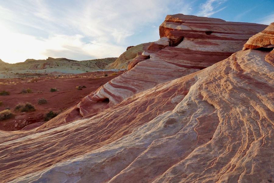
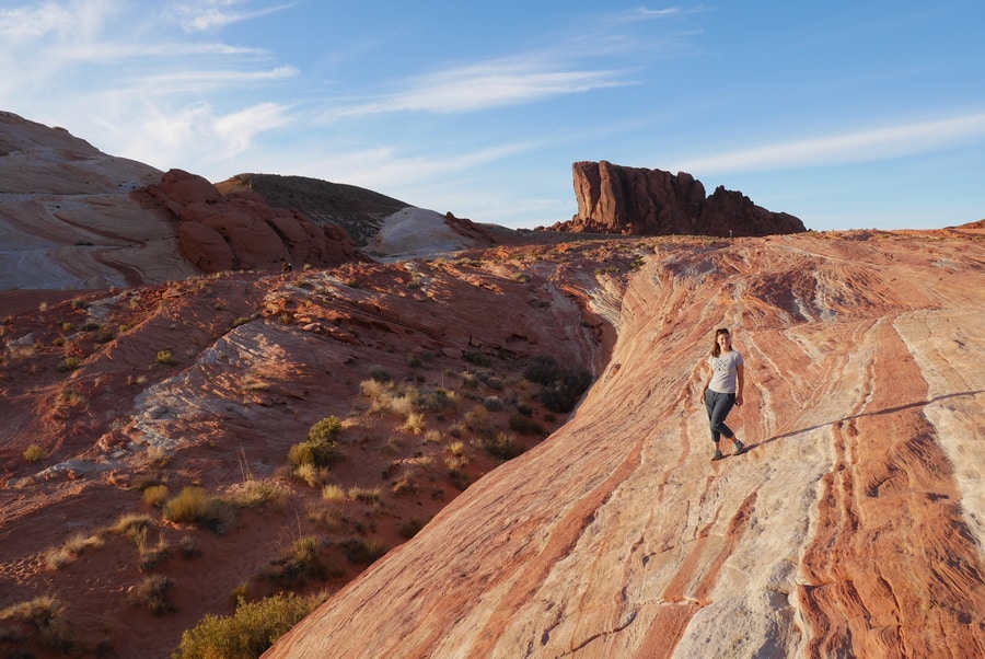
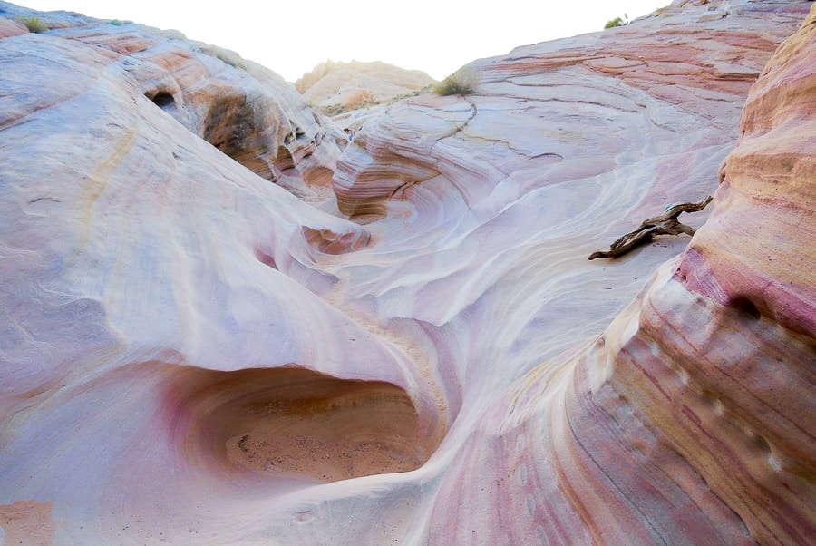
THE FIRE WAVE
The Fire Wave is the state park’s signature landmark and a destination that attracts photographers and hikers in droves. Like a mini version of Arizona’s Wave, it features sedimentary rock draped in a striped cloak of white, pink, and red. Yet, unlike the Wave, it doesn’t require a lottery to visit.
In fact, the Fire Wave is downright easily accessible. It is the centerpiece of a 1.5 mile roundtrip hiking trail.

During the late evening hours, sunlight casts a warm glow over the landmark and illuminates it in irresistibly colorful swirls.
Unfortunately, due to the hike’s popularity, it can be difficult to photograph the wave without capturing the myriad of other people who are trying to do the same.
THE PINK CANYON
Hiking the Pink Canyon is among the top things to do in Valley of Fire. The canyon is not marked on maps, nor do park rangers freely disseminate its location. Similar to Samuel H Boardman’s Secret Beach, it is a location that is both highly photogenic and somewhat elusive.
Luckily—while the official park map did its best to conceal the Pink Canyon’s location—Google Maps and Maps.me both came to our rescue.
I’m not exactly sure why there are no signs indicating the state park’s pastel-colored canyon. My best guess is that, since there are no authorized parking lots near the trailhead, park rangers want to discourage people from leaving their cars along the side of the road.
The best way to access the Pink Canyon legally is via the Fire Wave Trail. The pastel-colored canyon lies just south of the wave, near the state park’s main road.
THE WHITE DOMES
The White Domes Trail is one of the most beautiful hikes in Valley of Fire State Park.
In 1966, the area acted as a backdrop for a movie called The Professionals. The western, starring Lee Marvin, was allegedly responsible for the construction of a road leading to the White Domes.
Today, remnants of the movie set’s small hacienda remain near the trailhead.
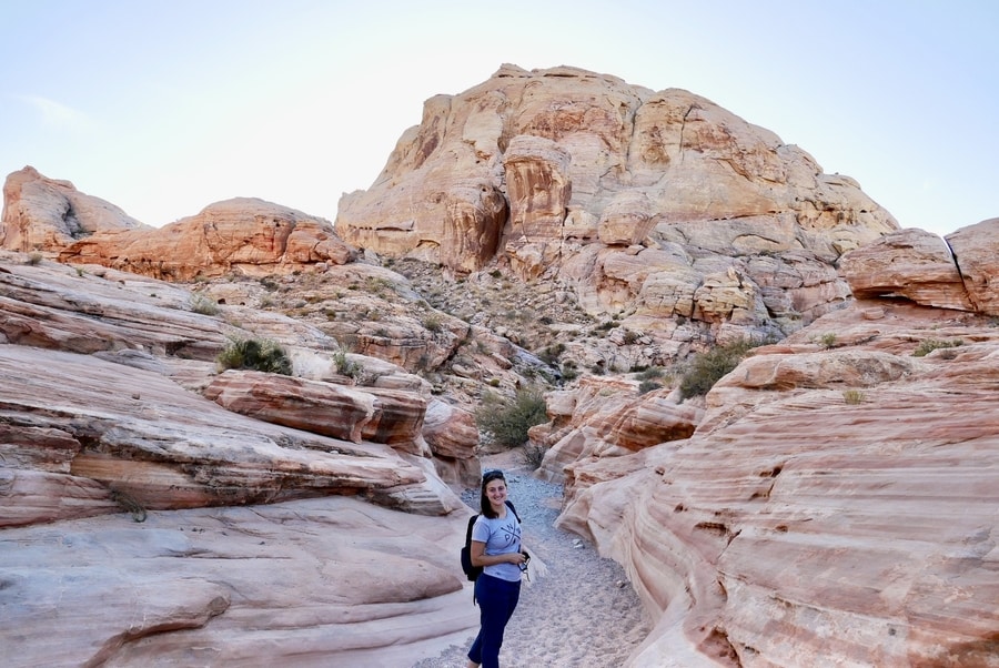
The White Domes Hike is a quick loop that highlights the diversity of the state park’s geologic landforms. The mile-long trail boasts sweeping desert vistas, a slot canyon, and towering rock walls.
MOUSE’S TANK
A half-mile trail to Mouse’s Tank leaves from the Petroglyph Canyon parking lot. I vaguely remember hiking the trail as a teenager and seeing a wall of rock art along the way.
On our most recent visit to the park, Dan and I had to prioritize our hiking itinerary due to winter’s shortened daylight hours. Thus, we didn’t have the chance to corroborate my childhood memories of the trail.
CAMPING AT VALLEY OF FIRE STATE PARK
Valley of Fire State Park lies less than an hour from Nevada’s commercial and tourism hub. Its proximity to Las Vegas makes it a feasible day trip destination.
For travelers who want a little more time in the park, camping is a fantastic option. Valley of Fire has two established campgrounds—Atlatl and Arch Rock—that are suitable for both tents and RVs. Additional primitive camping alternatives are available on the large swaths of BLM land that surround the park.
For travelers who aren’t keen on sleeping outdoors, the nearest hotel rooms can be found at Lake Mead’s North Shore Inn and, of course, in Las Vegas.
****
Las Vegas is one of America’s most touristy cities. Each year, millions flock to its casino-lined strip to gamble, eat at overpriced buffets, and pretend they are in Egypt, Rome, or New York.
With its rowdy streets and penchant for all things artificial, Las Vegas has never been my type of place.
Instead, you’ll find me 50 miles away, contemplating the seemingly impossible color of Valley of Fire’s orangey rocks.
_____________________________________________
Did You Enjoy this Guide to Valley of Fire’s Top Hikes and Viewpoints? Pin It!