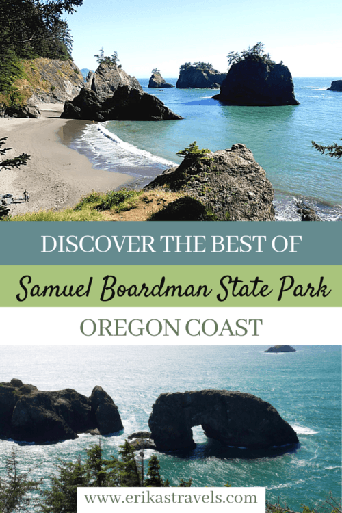
Samuel H Boardman State Park on the Oregon Coast
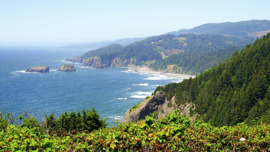
As Highway 101 winds along the Southern Oregon Coast’s rugged and wild shoreline, it showcases jaw-dropping vistas and superlative natural splendor.
The winding ribbon of road traverses some of the most breathtaking scenery in the Pacific Northwest. It features jagged rock monoliths, deserted beaches and sweeping sand dunes that have been sculpted by harsh winds and crashing waves over the course of millennia.
Oregon’s southern coastline is a testament to nature’s capacity for both careful creation and heedless destruction.
And nowhere is its harsh and fragile beauty more spectacular than along the Samuel H Boardman State Park—a twelve mile scenic corridor that boasts some of the most dramatic coastal landscapes on Earth.
SAMUEL H BOARDMAN STATE SCENIC CORRIDOR
The Samuel H Boardman Scenic Corridor—named in honor of the first Oregon Parks superintendent—lies between the towns of Gold Beach and Brookings. It is a treasure trove of beloved vistas and little-known gems.
Within a short distance, the scenic corridor contains secluded beaches, ancient trees, and mile upon mile of hiking trails. Offshore, the Oregon Islands National Wildlife Refuge protects the habitats of birds and marine mammals.
The state park’s spectacular scenery invites comparisons with some of the world’s other great coastal road trip destinations—like the Amalfi Drive in Italy, the Great Ocean Road in Australia, and Chapman’s Peak Drive in South Africa.
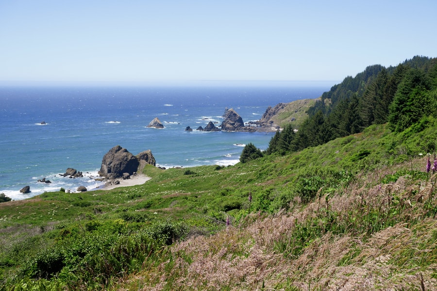
ROAD TRIP STOPS ALONG THE SCENIC CORRIDOR
The Samuel Boardman Scenic Corridor is a photographer’s wonderland, and a nature-lover’s dream.
As Dan and I drove along the corridor from north to south, we stopped at nearly every turnoff along the way.
And each time we stopped, arresting ocean views solidified the state park’s reputation as one of Oregon’s most eye-catching wonders.
ARCH ROCK
Arch Rock is the most well-known natural arch along the Oregon Coast. The rainbow-shaped monolith lies about 500 ft offshore, at the northernmost tip of Samuel H Boardman State Park.
Arch Rock was the first major attraction we encountered along the scenic corridor, and an introduction to the area’s staggering splendor.
From the paved parking lot, a half mile path leads to an overlook that features unobstructed views of Arch Rock. The short walking path veers to the left past a picnic area. En route, it showcases a smattering of delicate sea stacks and tree-tufted islands.
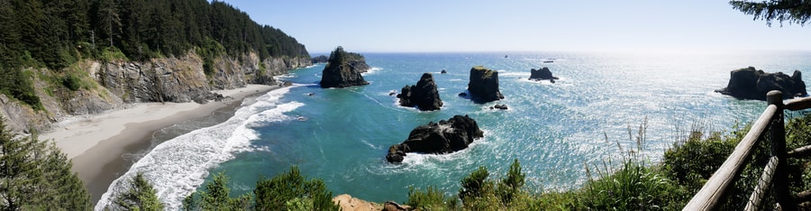
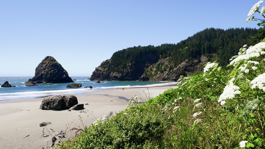
SECRET BEACH
Secret Beach is an unmarked gem nestled among the towering rock formations of the Samuel H Boardman State Scenic Corridor. It is a highlight of the state park and one of the Oregon Coast’s most photogenic spots.
The area around Secret Beach is a rugged natural wonderland complete with two streams, a small waterfall, dense forested vegetation, and a lonely stretch of sand. Delicate sea stacks puncture the beach’s secluded crescent of sand and frame a vista that is worthy of National Geographic’s cover page.
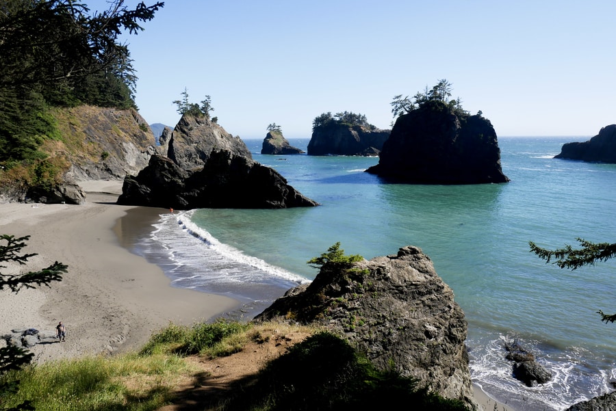
Despite being one of the Oregon Coast’s most beloved photo spots, Secret Beach remains largely true to its name—thanks to the fact that its location has been omitted from most maps.
The pullout to Secret Beach lies near mile marker 345, about a quarter mile north of the Natural Bridges Viewpoint. Since it is an unmarked and unofficial attraction, it is easy to miss.
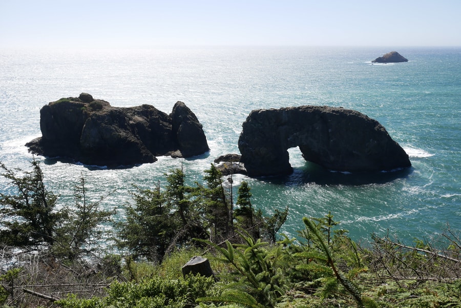
NATURAL BRIDGES
The Natural Bridges Viewpoint is another of the Samuel Boardman Scenic Corridor’s most noteworthy road trip stops. Unlike Secret Beach, however, it is well signposted and easy to find.
The popular attraction features a series of wave-sculpted natural bridges that rest inside a picturesque cove. Its viewing platform lies a few feet away from the start of the trailhead. It provides a breathtaking snapshot of the seven sea arches that frame the cove’s azure waters.
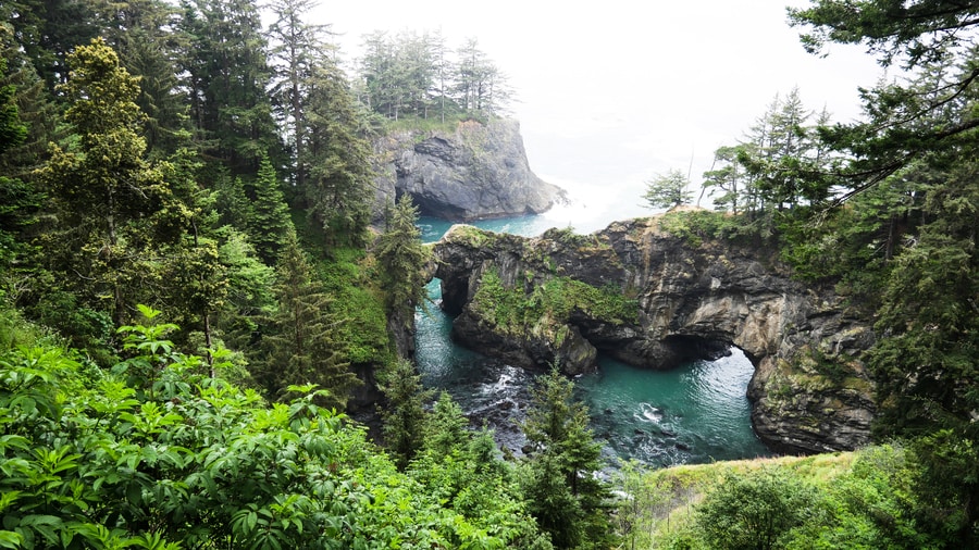
A path descends from the attraction’s main viewpoint and affords up-close views of the natural bridges.
Dan and I did not hike to the second viewpoint. The waning daylight hours and Samuel H Boardman’s plethora of other places to visit, convinced us to continue our journey southward.
THOMAS CREEK BRIDGE
While the southern Oregon Coast puts on a constant show of nature’s grandeur, the Thomas Creek Bridge is proof of humankind’s remarkable achievements.
The lofty bridge rises 345 feet above a ravine. It is the tallest bridge in Oregon, and among the highest in the United States.
Designed by Ivan D. Merchant in 1961, the 956 ft structure consists of three steel deck Warren trusses that are supported by steel-frame towers.
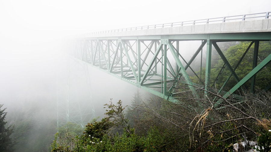
To appreciate the structure’s magnitude, Dan and I pulled into the parking area at the bridge’s south end.
From there, we walked about 100 meters northward, for views of the bridge fading into mist.
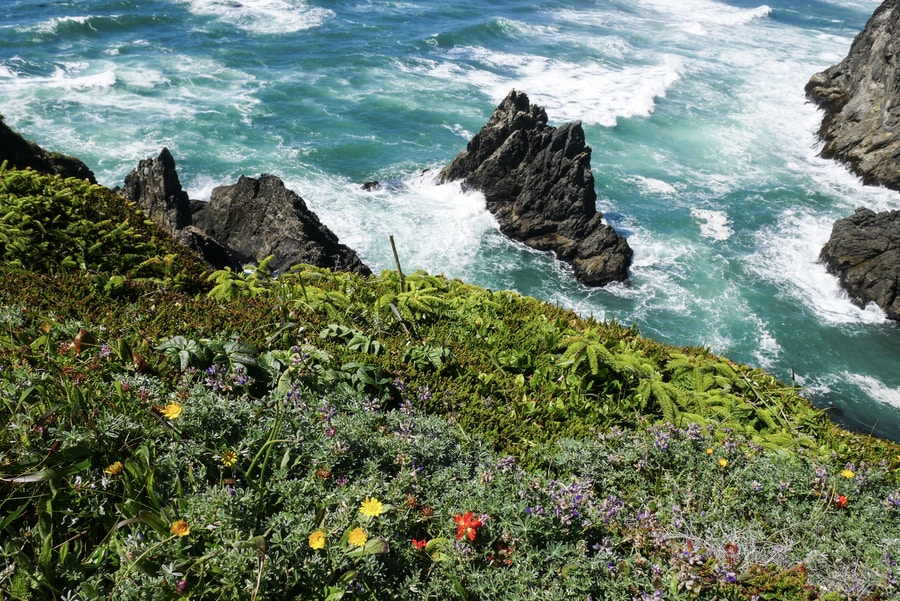
INDIAN SANDS
Indian Sands lies nestled between the Thomas Creek Bridge and Whaleshead Beach. It is a unique area that features desert-like dunes and wildflower-strewn grasslands.
Fields of wildflowers and succulents spread over the grasses and bloom in rocky crags. It is splendid. Wild. Untouched. And largely crowd-free.
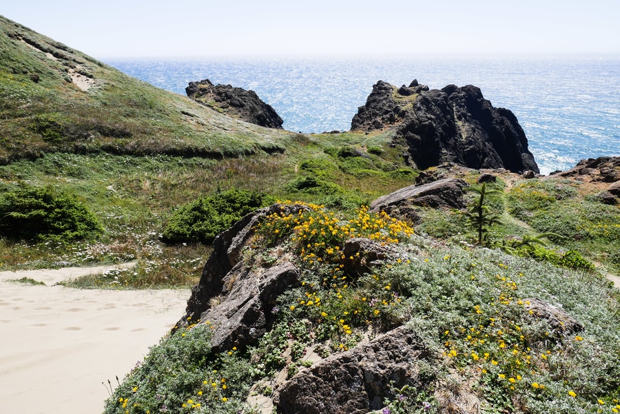
A short trail from the parking area leads to sandstone rock formations and sloping dunes.
The dunes at Indian Sands differ quite a bit from those found at the Oregon Dunes Recreation Area. Rather than being fed by the ocean, the formations are a result of eroding sandstone.
WHALESHEAD BEACH AND VIEWPOINT
At a mile long, Whaleshead is the longest beach in the Samuel Boardman Scenic Corridor. It boasts a picnic area, gorgeous views, three small streams, and a wildflower-speckled backdrop.
The beach takes its name from a sea stack that purportedly spouts water into the air when waves hit it at a certain angle.
Whaleshead Beach is easily accessible from a parking lot near milepost 349.
HOUSE ROCK VIEWPOINT
At the House Rock Scenic Viewpoint, a memorial plaque commemorates the state park’s namesake superintendent, Samuel H Boardman.
Boardman felt a great responsibility to protects Oregon’s untouched scenery for future generations. He was a staunch supporter of conservation and is largely responsible for the pristine state of Oregon’s public lands.
Aside from displaying an important commemorative marker, House Rock viewpoint certainly merits a photo opportunity. To the north, views extend to the cliffs of the Cape Sebastian Scenic Corridor. To the South, it is possible to see into California.
CAPE FERRELO VIEWPOINT
South of Whaleshead Beach, a mile-long hike leads to breathtaking views of Cape Ferrelo’s rugged coastline. The trail passes trees and brush and leads to some of the most striking views in the area.
In Spring and Fall, Cape Ferrelo is an optimal spot for whale watching.
A trail connects Cape Ferrelo with House Rock and Lone Ranch Beach.
****
Highway 101 showcases one of the world’s most beautiful marriages of land and sea. Along its entire length, it displays a visual feast of sea stacks, cliffs, and secret beaches.
Samuel H Boardman State Park is the crown jewel of Oregon’s windswept shores. No other destination along its rugged expanse can claim such a dense collection of photogenic gems and geologic marvels.
Which is lofty praise, considering the hyperbolic beauty of the entire coastline’s 300+ miles.
___________________________
Did You Enjoy this Guide to the Samuel Boardman State Park? Pin It!