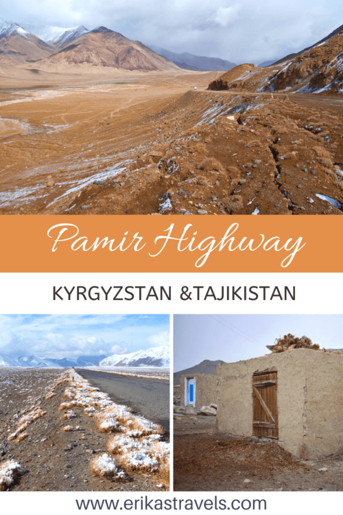
Pamir Highway Road Trip Itinerary
The Pamir Highway is a high-altitude road that bypasses some of the most dramatic mountain scenery in Central Asia. Traversing the Roof of the World, this spectacular ribbon of pavement winds between craggy peaks, past glistening lakes and through lunar landscapes.
Formally known as the M-41, the Pamir Highway extends from Osh in Kyrgyzstan to Mazar-i-Sharif in Afghanistan. Driving along the Pamir Highway is an ultimate road trip adventure for lovers of culture and off-the-beaten path wilderness.
PAMIR HIGHWAY: PLANNING AND LOGISTICS
After two weeks in Kyrgyzstan and southern Kazakhstan, I flew from Bishkek to Osh in order to begin my Pamir Highway road trip. By this point in my travels to Central Asia, Dan and Courtney had both returned to the United States. As a result, I found myself alone for the most adventurous leg of my month-long journey.
And what an adventure it was.
Traveling the Pamirs is not easy.
Roads–even along the main thoroughfare–are in in terrible shape. Homestays are rudimentary. Hygiene standards are foreign concepts. And even for those who think they’ve penned down their perfect route, altitude sickness, landslides and severe weather can turn carefully-planned itineraries upside down.
-
HOW TO TRAVEL THE PAMIRS
There are several ways to travel the Pamir Highway. Some budget travelers choose to hitchhike or rely on limited public transport between larger towns. Others choose to cycle the high altitude road in a show of mental fortitude and physical strength.
Most, however choose to hire a driver to take them from Osh to Khorog on a road trip varying between four and ten days.
Knowing I wanted to hire a vehicle for the route, I began scouring forums and reading travel blogs in preparation for my trip. With the help of the Internet, I found three other people—a Dutch/Polish couple and a solo Malay traveler—with whom to share the journey. We met at the Osh Guesthouse and finalized logistics.
Two days later, with a jeep full of newfound friends, a bag full of layered clothing, a head full of apprehension and heart yearning for adventure, I set out into the unknown.
We organized a five day tour with Visit Alay–a company that focuses on travel to southern Kyrgyzstan and Tajikistan.
-
PAMIR HIGHWAY TRAVEL COSTS
The cost of traveling along the Pamir Highway varies depending on number of people, length of time and total kilometers traveled. Between the four of us, we payed $225 per person for five days. The price included transportation, as well as meals and lodging for our driver. It excluded our own meals and accommodation, which usually ranged between $15-20 extra per day.
-
VISAS AND PERMITS FOR THE PAMIR ROAD TRIP
Traveling the Pamirs requires a bit of advanced planning. As an American, I needed to organize a Tajikistan e-visa and GBAO Permit before crossing the border between Kyrgyzstan and Tajikistan.
The GBAO Permit is a document that allows for travel through Tajikistan’s Gorno Badakhshan Autonomous Province. Both the visa and permit can be easily obtained online in a couple days.
PAMIR HIGHWAY: ROUTE AND ITINERARY
Our five day Pamir Highway itinerary brought us from Osh to Khorog via the Wakhan Valley. From Khorog, we hired a 4X4 shared taxi to take us the remaining 600km to Dushanbe–Tajikistan’s capital city.
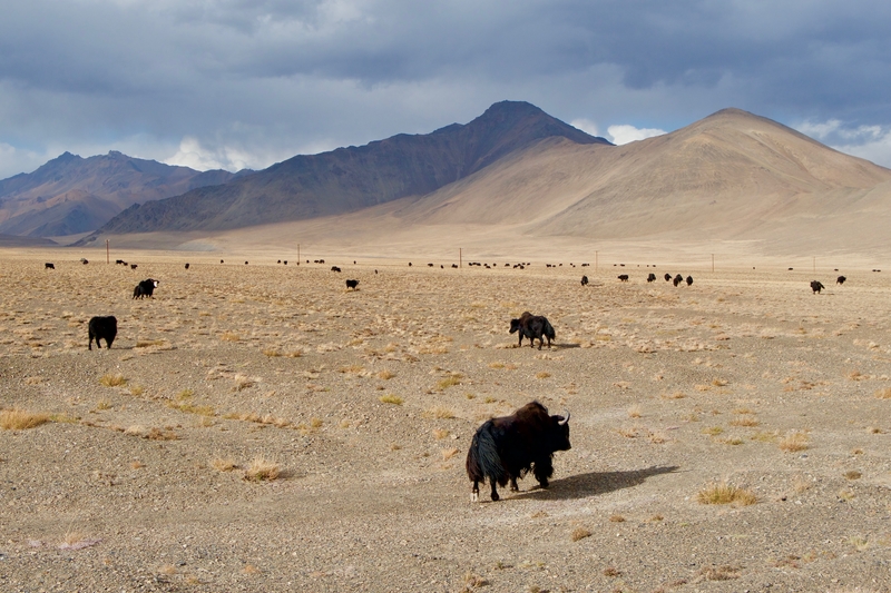
Over the course of five days, we ogled at the snow-capped Peak Lenin, meandered through yak-studded pastures and peered into Afghanistan’s Wakhan Corridor.
-
DAY 1: OSH TO PEAK LENIN BASE CAMP
The first leg of our journey brought us to the Alay Region of southern Kyrgyzstan. Home to undulating golden landscapes and soaring mountain peaks, this spectacular area of the country cemented my love for Kyrgyzstan as a trekking destination.
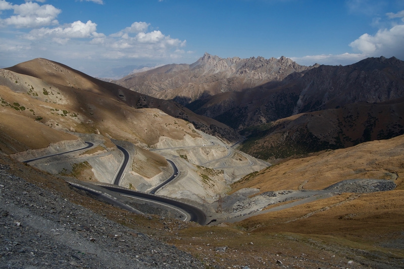
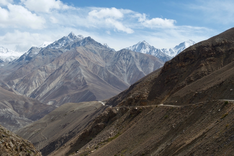
From Osh, we joined the M-41 and began our steady climb into the Pamirs. As we drove higher and higher toward the Roof of the World, the scenery grew more breathtaking by the minute.
Along the way, we watched daily life unfold. We passed by red rock canyons, winding mountain passes and tiny villages where time seems to have stood still. There were few other vehicles traveling the Pamir Highway. Most roadblocks we encountered consisted of herders leading their cows and sheep to water.
On our first night along the Pamir Highway, we stayed in yurts at the Peak Lenin Base Camp near Sary Mogul. The yurt camp sits along the shores of Turparkol Lake, nestled among rolling hills of golden grass.
We arrived at Peak Lenin with time to settle into our yurts, enjoy a short walk along the lake, and soak in the surrounding views.
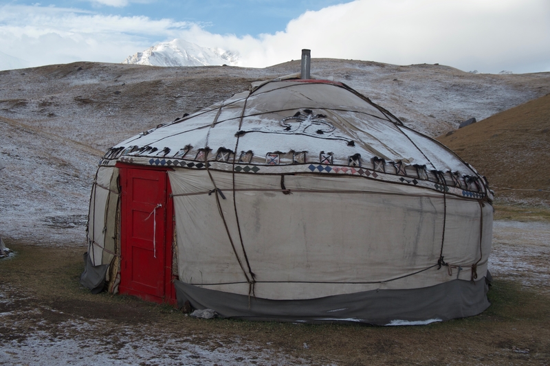
The camp’s lakeside setting is magical in all directions. Treeless golden hills undulate under the vast sky, spanning out in all directions. To the north, a ring of purple mountains linger on the horizon. To the south, Peak Lenin’s towering massif looms overhead.
-
DAY 2: PEAK LENIN TO KARAKUL
On the second morning of our Pamir Highway tour, we woke up to a layer of snow blanketing the surrounding mountains. Our Pamir Highway itinerary afforded us a bit of time to explore the area prior to hitting the road, so I set off into Peak Lenin’s wilderness for a few hours.
From the yurt camp, a trail leads toward Traveler’s Pass. At every step of the way, gold-gilded mountains and snow-capped peaks took my breath away. I had difficulty putting my camera down.
Unfortunately, I didn’t have time to complete the trail before leaving. A combination of lack of time and breathlessness from the altitude forced me to turn back after a few kilometers. The vistas I saw, however, were some of the most extraordinary of the entire trip.
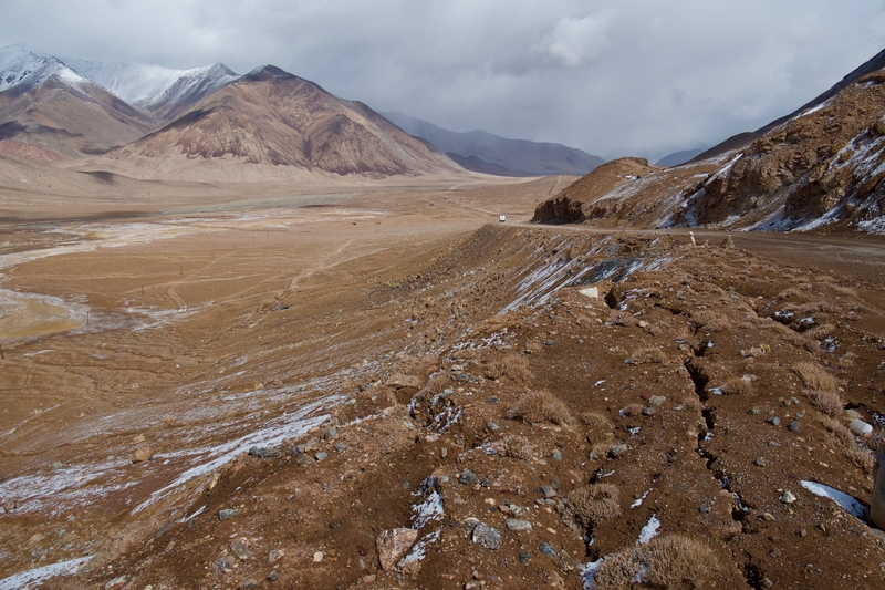
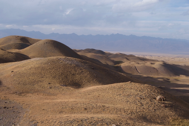
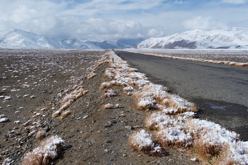
Upon leaving Peak Lenin, we continued skyward, toward the Tajikistan border. As we climbed in elevation, the golden grasses of Kyrgyzstan gave way to Tajikistan’s lunar landscapes. For the next few days, I felt as though I was cruising along the surface of the moon.
A few hours after crossing the Tajikistan border, we arrived in Karakul–an expansive mountain-ringed lake situated within an impact crater. The mud-brick village of Karakul lies along the shores of the lake. The town is small and eerily quiet. Though we were visiting in late summer, temperatures were near freezing and we could see smoke rising from the chimneys of the mud-walled houses.
My companions and I bundled in our warmest clothes, meandered through the village and walked to the shores of the lake. When our fingers and faces stung from the cold, we retired to our cozy homestay for dinner and a cup of warm tea.
-
DAY 3: KARAKUL TO ALICHUR
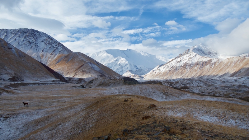
The following morning, we left Karakul and sailed past scree-covered valleys, toward Murghab. Though it was summer, harsh winds bit at my face. Snowflakes danced about, slowly covering the ground in a thin layer of white.
The third day of our Pamir Highway road trip brought us to the highest point on our journey–the 4655 meter Akbaital Pass. We crossed the pass and admired the sweeping views of the barren valley, careful to avoid physical exertion at every cost. The altitude was not only visible, it was also tangible. As we soared higher and higher into the Tajik Mountains, we could feel the air grow thinner. Our breaths accelerated in rapid succession. When we ran out of the car for a bathroom breaks, we would often find ourselves gasping for air.
After crossing the pass, we descended to the village of Murghab for a lunch break. Our driver–a friendly Tajik from Murghab–invited us to his home for lunch and a chance to meet his family.
For a few hours, we interacted with our driver’s hospitable wife and kids. Then, giving him a little privacy with his family, we set out to explore Murghab’s shipping container market before continuing to our homestay in Alichur.
Murghab sits at a cross-roads. Positioned between China and Afghanistan, this makeshift town was a 1895 Soviet military outpost that signified the farthest reaches of the Soviet Empire. Seemingly at the edge of civilization, it has a temporary frontier feel.
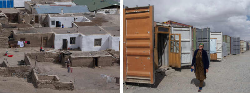
The landscape surrounding Murghab is bleak, with not a tree or shrub in sight. In all directions, the scenery is empty. Eerie. Desolate.
The Pamiri women of Murghab wear scarves wrapped around their entire heads–revealing only a small slit for the eyes–to shield against the wind and dust. As we walked around town, the wind bit at my face. It was not even Autumn yet, and still we had to battle the elements.
I could only begin to imagine the harsh reality of life in the Pamirs.
-
DAY 4: ALICHUR TO LANGAR
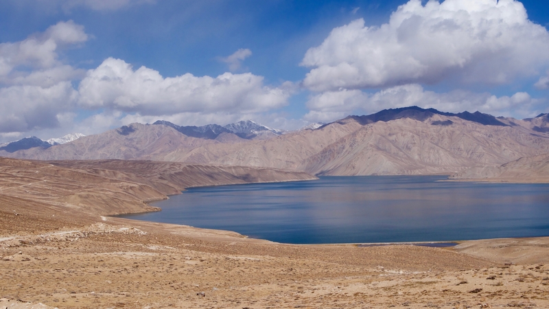
The fourth day of our Pamir Highway tour consisted of vast glassy lakes, wide open skies and yak-studded pastures. We covered a relatively short stretch of road during the fourth day of our road trip. In this section, we took short hikes around glistening lakes and frequently got out of the car to stretch our legs.
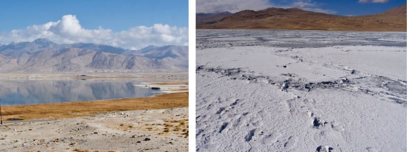
Lakes Bulunkul and Yasilkul lie a few kilometers off of the M-41. We took the detour toward the lakes and were asked to pay a small fee before reaching the Yasilkul lookout. The fee (paid to a local man from a small village near the road turnoff), seemed like a ploy to make a couple dollars off of tourists.
Regardless, I happily handed over two dollars in exchange for views over the lake’s sky-blue waters. In the high altitude lunar landscapes of the Pamirs, the lakes look like mirages–their placid surfaces reflecting the massive skies overhead.
From the chain of lakes, we continued toward the Afghan border.
There, we handed over our documents at a checkpoint, turned onto a particularly bumpy stretch of road and caught our first glimpses of Afghanistan from across the river.
-
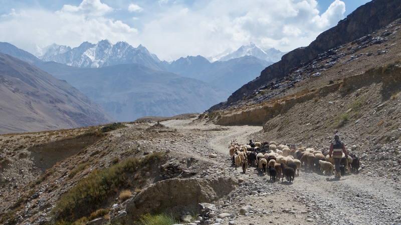
DAY 5: LANGAR TO KHOROG VIA THE WAKHAN CORRIDOR
The Wakhan Valley is a popular detour from the M-41. The bumpy gravel road follows the Panj river as it winds between some of Central Asia’s tallest peaks.
The entire corridor on either side of the river is speckled with mud-walled villages that are nestled in fertile plots of cultivated land. Unlike the lunar landscapes we had encountered on days 2-4 of our Pamir Highway tour, the Wakhan Valley is home to trees and patches of green earth. Beyond these fertile slivers of green, towering valley walls give way to glimpses of the Hindu Kush mountains.
Small human settlements lie along the river, strung together by patches of arable land. Among these villages, ruins of caravanserais and forts stand as a testament to the area’s storied past.
The main highlight along the Wakhan Corridor the Yamchun Fortress–a stone structure that dates back to the 3rd century BC and overlooks fertile lands on either side of the Panj.
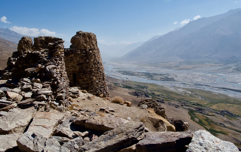
Apart from the beauty of the journey, the Wakhan Corridor’s proximity to Afghanistan makes it a fascinating detour from the M-41.
Villages along the Wakhan Corridor look as though they’ve remained untouched for centuries. I was so close to Afghanistan, that I could practically touch its soil with my outstretched arms. Across, the river, I waved at Afghan caravans leading their herds to the water. I watched women wash their clothes along the riverbanks. I glimpsed children running about, playing as though they had not a care in the world.
It was an eye-opening window into a forbidden and hauntingly beautiful country. A country that I one day hope is safe enough to explore.
***
A road trip along the Pamir Highway is not for the inexperienced traveler. For those accustomed to luxuries on the road, the Pamir Highway can be a challenge. There is little variety in the food, accommodation is rudimentary at best, and toilet facilities are among the most revolting I’ve ever come across.
But travelers willing to step outside of their comfort zones, will find that there are few adventures more rewarding than a road trip along the Roof of the World.
__
Like this Pamir Highway Road Trip Guide? Pin it!